Ages: Colin was 71 years and 310 days. Rosemary was 69 years and 87 days.
Weather: Cold and foggy all the morning. Clearing in the afternoon, but only thin
sunshine and not really much warmer.
Location: Clynnog Fawr to Nefyn.
Distance: 14 miles.
Total distance: 3620 miles.
Terrain: Mostly mountain footpaths — uneven and some overgrown with brambles. Occasionally muddy. Very undulating!
Tide: Going out.
Rivers: None.
Ferries: None.
Piers: None.
Kissing gates: Nos.676 to 697 spread throughout the Walk. (21 in all!)
Pubs: None.
‘Cadw’ properties: None.
Ferris wheels: None.
Diversions: None.
How we got there and back: We were staying in a holiday cottage near Criccieth. This morning we drove to Nefyn and parked just up the road from the bus stop. We caught a very early bus (07.28, and the only one all day!) to Trefor where we had to wait a cold ten minutes for another bus which took us to Clynnog Fawr.
At the end we came to our car in the dark. We had our tea and chocolate biscuits, then returned to our cottage.
The next day we returned home to Malvern.

 We started today’s Walk in the village
of Clynnog Fawr. It was cold with a thin fog which was not
lifting. We passed the remains of an old
smithy with a water-wheel in a tiny dried up stream. Clynnog Fawr has a huge church which looked
quite interesting, but mindful of the long trek ahead we didn’t stop to look
inside today. We said we’d come back to
it another time, but we never did.
We started today’s Walk in the village
of Clynnog Fawr. It was cold with a thin fog which was not
lifting. We passed the remains of an old
smithy with a water-wheel in a tiny dried up stream. Clynnog Fawr has a huge church which looked
quite interesting, but mindful of the long trek ahead we didn’t stop to look
inside today. We said we’d come back to
it another time, but we never did.
 We
could see a rookery on a distant tree.
The birds were making a heck of a racket, we felt sorry for the people
living nearby!
We
could see a rookery on a distant tree.
The birds were making a heck of a racket, we felt sorry for the people
living nearby!
We walked alongside the main road for nearly half a mile to where our OS map told us the Coast Path turns off to the left and runs parallel to the road along the bottom of the mountains.
 Sure enough there was a footpath leading off
inland but the sign only had a walking man on it, it didn’t have the Coast Path
logo. We turned on to it anyway because
we’d had enough of the road. It took us
alongside a babbling brook which was very pretty, then we crossed the stream on
a footbridge.
Sure enough there was a footpath leading off
inland but the sign only had a walking man on it, it didn’t have the Coast Path
logo. We turned on to it anyway because
we’d had enough of the road. It took us
alongside a babbling brook which was very pretty, then we crossed the stream on
a footbridge.

 Following that, a good
footpath took us through trees. Some of
the smaller trees were so sheltered they were still covered in autumn
leaves! They looked very colourful.
Following that, a good
footpath took us through trees. Some of
the smaller trees were so sheltered they were still covered in autumn
leaves! They looked very colourful.
 The trees came to an end, and we climbed over a wall using ‘granny’s
teeth’ (I swear I have not got teeth which stick out like
that!) and out into the open. There the
path deteriorated as paths have a habit of doing. It hadn’t been maintained and was blocked by
brambles in places. Good job it was
winter so we were able to get by — just.
There were no path signs, we had to use our initiative as we crossed the
fields. We managed to stay on the path,
I don’t know how. We sat on some stones
and ate our pasties. The mountains ahead
were still wreathed in mist.
The trees came to an end, and we climbed over a wall using ‘granny’s
teeth’ (I swear I have not got teeth which stick out like
that!) and out into the open. There the
path deteriorated as paths have a habit of doing. It hadn’t been maintained and was blocked by
brambles in places. Good job it was
winter so we were able to get by — just.
There were no path signs, we had to use our initiative as we crossed the
fields. We managed to stay on the path,
I don’t know how. We sat on some stones
and ate our pasties. The mountains ahead
were still wreathed in mist.
 We passed a derelict cottage, then the path turned into a track as it
passed some more houses. It didn’t look
right, the track seemed too posh somehow.
We studied the map and feared we had overshot a turning. If we continued down the track we would
possibly end up on the road again. A
woman looked over her garden gate and confirmed this. She told us the Coast Path turns off further
back leading higher up, but there were no logos or signs. We went back looking carefully, and found an
inconspicuous path leading off to the left, zigzagging uphill. It was not marked like that on our OS
map. It was narrow and overgrown,
sometimes it didn’t look like a real path at all. Occasionally we came to an iron kissing gate
between the fields, this was the only way we knew we were still on the
footpath. There were no Wales Coast Path
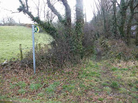
logos, and few other footpath signs.
We passed a derelict cottage, then the path turned into a track as it
passed some more houses. It didn’t look
right, the track seemed too posh somehow.
We studied the map and feared we had overshot a turning. If we continued down the track we would
possibly end up on the road again. A
woman looked over her garden gate and confirmed this. She told us the Coast Path turns off further
back leading higher up, but there were no logos or signs. We went back looking carefully, and found an
inconspicuous path leading off to the left, zigzagging uphill. It was not marked like that on our OS
map. It was narrow and overgrown,
sometimes it didn’t look like a real path at all. Occasionally we came to an iron kissing gate
between the fields, this was the only way we knew we were still on the
footpath. There were no Wales Coast Path
logos, and few other footpath signs.
I was ahead of Colin as I walked through a wide gate and continued along a ‘posh’ track towards a farmhouse. The fog had barely lifted, but the sun had just started to come out and was shining right in my eyes. That is why I didn’t see a Coast Path sign pointing behind the farmhouse before the wide gate. (I didn’t see a tree either and walked right into its branches!) Two men were standing there and they asked, “Are you lost?” I didn’t think so because, according to the map, the footpath goes in front of the buildings where we were standing. They told me that the Wales Coast Path now runs behind the buildings, but the authorities had not put up signs despite sending them all the literature about it. They were very keen to explain to me the way I should be going, and while they were doing so Colin caught up with me.
 He said he’d seen a Coast
Path sign with an arrow pointing behind the buildings, but it was a different
sign which had no logo. “Yes, we put
that up ourselves!” said one of the men.
I apologised for missing the sign because of the sun in my eyes, and we
retreated to the wide gate.
He said he’d seen a Coast
Path sign with an arrow pointing behind the buildings, but it was a different
sign which had no logo. “Yes, we put
that up ourselves!” said one of the men.
I apologised for missing the sign because of the sun in my eyes, and we
retreated to the wide gate.

 We turned left through a narrow gate, but the path was overgrown again so
it wasn’t easy to get through in places.
We came to a deserted winching house with some of the wheels and cables
still there. It appeared they had been
quarrying a slatey type rock with fossils in it, don’t know what it would have
been used for.
We turned left through a narrow gate, but the path was overgrown again so
it wasn’t easy to get through in places.
We came to a deserted winching house with some of the wheels and cables
still there. It appeared they had been
quarrying a slatey type rock with fossils in it, don’t know what it would have
been used for.

 We walked through a gully
where the gorse got thicker and thicker making progress very difficult
indeed. It’s a good job it was winter
because, if the summer growth had been on those bushes, we would never have got
through.
We walked through a gully
where the gorse got thicker and thicker making progress very difficult
indeed. It’s a good job it was winter
because, if the summer growth had been on those bushes, we would never have got
through.
 The fog was still refusing to leave the mountains, in fact it seemed to
be getting worse. Navigation across the
fields was problematic because of the lack of signs. This is certainly a badly maintained and a badly
signed stretch of the Wales Coast Path.
Several times we felt we had gone wrong, but through a lot of good luck
and oodles of guesswork we managed to find the correct path in the end. Eventually we found our way down towards
Trefor though a more obvious path led straight on, and if we’d taken it we would
have missed the village. We met a local
man with his dog who advised us against taking the path straight across the
main road which led to the beach because it was too boggy to walk. We hadn’t intended going that way anyway, but
thanked him for the information.
The fog was still refusing to leave the mountains, in fact it seemed to
be getting worse. Navigation across the
fields was problematic because of the lack of signs. This is certainly a badly maintained and a badly
signed stretch of the Wales Coast Path.
Several times we felt we had gone wrong, but through a lot of good luck
and oodles of guesswork we managed to find the correct path in the end. Eventually we found our way down towards
Trefor though a more obvious path led straight on, and if we’d taken it we would
have missed the village. We met a local
man with his dog who advised us against taking the path straight across the
main road which led to the beach because it was too boggy to walk. We hadn’t intended going that way anyway, but
thanked him for the information.
 We came to the main road, turned left on a cycleway, then crossed the
road. We walked into Trefor past the bus
stop where we had changed buses this morning.
We turned right and walked down to the harbour. The
sun had disappeared and the fog taken over again. We sat at a picnic table to eat our sarnies,
but it was cold so we didn’t dally long.
We came to the main road, turned left on a cycleway, then crossed the
road. We walked into Trefor past the bus
stop where we had changed buses this morning.
We turned right and walked down to the harbour. The
sun had disappeared and the fog taken over again. We sat at a picnic table to eat our sarnies,
but it was cold so we didn’t dally long.
 We walked round the harbour, but not on the pier because it was chained
off with a notice saying it was unsafe.
Looking through the gate we could see at least two dips in the rotting
wood. Wooden piers are no match for
nature!
We walked round the harbour, but not on the pier because it was chained
off with a notice saying it was unsafe.
Looking through the gate we could see at least two dips in the rotting
wood. Wooden piers are no match for
nature!

 We walked south-west from the harbour up on the cliffs and round a
Head. The cliffs are made of a
spectacular black rock which had been quarried at some time in the past. We saw shags on the rocks and wondered
whether they were nesting yet. There
were spectacular views of the rocks, but it was quite cold on top so we didn’t
hang about.
We walked south-west from the harbour up on the cliffs and round a
Head. The cliffs are made of a
spectacular black rock which had been quarried at some time in the past. We saw shags on the rocks and wondered
whether they were nesting yet. There
were spectacular views of the rocks, but it was quite cold on top so we didn’t
hang about.

 There was a present-day
quarry marked on the map, but when we got there it looked like a fortress. We couldn’t understand whether this was an
historic building, or what?
There was a present-day
quarry marked on the map, but when we got there it looked like a fortress. We couldn’t understand whether this was an
historic building, or what?
The path turned inland before we reached the quarry. The way was complicated, we really needed a magnifying glass to see the detail on the map. But we didn’t have one, so we coped without. We went under a tramway, took several tiny doglegs, crossed over fields and marched along lanes, always steeply upwards.
 We saw a brightly coloured bird
in a tree, but as we approached it we realised it was stuffed! Were we in the real world? We started to climb seriously. We
stopped at a drystone wall to eat our apples.
The sun began to
poke through the fog and it got a fraction warmer.
We saw a brightly coloured bird
in a tree, but as we approached it we realised it was stuffed! Were we in the real world? We started to climb seriously. We
stopped at a drystone wall to eat our apples.
The sun began to
poke through the fog and it got a fraction warmer.
 We climbed and climbed and climbed and
climbed, over a thousand feet above sea level!
I was slow, I am not nearly as fit as I would like to be.
We climbed and climbed and climbed and
climbed, over a thousand feet above sea level!
I was slow, I am not nearly as fit as I would like to be.
 The views were amazing, and we were relieved
to find the path was well-signed because a lot of it led over open
moorland.
The views were amazing, and we were relieved
to find the path was well-signed because a lot of it led over open
moorland.
 It seemed we were never going
to reach the top, we thought every ridge we were making for was the summit, but
when we got there another ridge rose before our eyes — a familiar scenario to
us on our Walks.
It seemed we were never going
to reach the top, we thought every ridge we were making for was the summit, but
when we got there another ridge rose before our eyes — a familiar scenario to
us on our Walks.

 At last we arrived at the top! Colin was delighted to find frogspawn in one
of the ditches at that altitude. Then he
came across some dried-out frogspawn on the path and he was not so
delighted. We met a track which took us
gently down to a car park — we could walk faster going downhill. We hadn’t quite climbed to the top of the
mountain Yr Eifl, but almost. There were
spectacular views in all directions.
At last we arrived at the top! Colin was delighted to find frogspawn in one
of the ditches at that altitude. Then he
came across some dried-out frogspawn on the path and he was not so
delighted. We met a track which took us
gently down to a car park — we could walk faster going downhill. We hadn’t quite climbed to the top of the
mountain Yr Eifl, but almost. There were
spectacular views in all directions.

 There was a standing stone sculpture in the car park, but it was
difficult to photograph because the sun was very bright and in our eyes. (We often seem to be walking into the sun low
in the sky.) We turned sharp right and
took a zigzag road down to sea level again.
It was very steep, it made my legs ache and feel like jelly. My thigh muscles don’t like such steep
slopes.
There was a standing stone sculpture in the car park, but it was
difficult to photograph because the sun was very bright and in our eyes. (We often seem to be walking into the sun low
in the sky.) We turned sharp right and
took a zigzag road down to sea level again.
It was very steep, it made my legs ache and feel like jelly. My thigh muscles don’t like such steep
slopes.

 The amazing views made us
realise how high we had climbed since Trefor.
Colin kept talking a load of nonsense about what he’d do if he took over
a derelict farm in the valley. I wasn’t
the slightest bit interested because my legs were aching so. Near the bottom we passed an even more
derelict farm building, so I ‘offered’ it to him to do up. He shut up then!
The amazing views made us
realise how high we had climbed since Trefor.
Colin kept talking a load of nonsense about what he’d do if he took over
a derelict farm in the valley. I wasn’t
the slightest bit interested because my legs were aching so. Near the bottom we passed an even more
derelict farm building, so I ‘offered’ it to him to do up. He shut up then!
As we reached the bottom my legs felt so weak I had to sit down on a rock at the entrance to the village of Nant Gwrtheyrn. It was a quarry village opened in the 1860s to quarry stone for road surfacing. The stone was shipped out by sea, so the village remained very isolated because of the hill behind it. The quarry closed eighty years later during the Second World War, and was abandoned. It is now a sort of museum and a Welsh Language Centre. While resting we ate our chocolate, and wished we had brought second bars because we still had quite a way to go.
An elderly man stopped his car and kindly offered us a lift back up the hill we had just climbed down. We thanked him, but turned him down because we planned to walk out the other way. Other way? Didn’t know there was one! Oh yes there is (we hope) because the way-marked footpath is marked on our OS map. It was only 4pm, but it seemed the place was packing up for the day. Workers in the car park were about to leave, and the café and toilets were locked up.

 We walked past them all. The Wales
Coast Path was well signed, so we felt confident as we went down a good path
almost to the beach. We crossed the
beach in front of old quarry workings, and then began to climb —
Aaaaaarrgh! Not again!
We walked past them all. The Wales
Coast Path was well signed, so we felt confident as we went down a good path
almost to the beach. We crossed the
beach in front of old quarry workings, and then began to climb —
Aaaaaarrgh! Not again!

 The path was grassy and narrow, but it was
not blocked and well signed. We passed a
couple of wild goats, more suited to this sort of terrain than we were.
The path was grassy and narrow, but it was
not blocked and well signed. We passed a
couple of wild goats, more suited to this sort of terrain than we were.
We came to an old tree which had been cleverly turned into a sculpture of a horse. Giddy-up! I wished it was a real horse that I could ride because I was very tired by then.
 We
crossed a babbling brook in a dip, then up and up and up. Our consolation was the spectacular
views.
We
crossed a babbling brook in a dip, then up and up and up. Our consolation was the spectacular
views.

 We were glad the weather was calm
because we could see by the leaning trees that it can often be very windy on
that slope.
We were glad the weather was calm
because we could see by the leaning trees that it can often be very windy on
that slope.
 There were oakapple-type
growths on some of the trees and we wondered what kind of bug had caused them.
There were oakapple-type
growths on some of the trees and we wondered what kind of bug had caused them.
Up and up and up — my legs were killing me! We were making for a gate at the top which was in front of some houses. We read a notice about a permissive path, but we were so tired we didn’t quite take in what it said.
 We went through the gate,
but now where? There were no Wales Coast
Path signs to be seen. We went behind
the buildings, but the tracks all took us away in the wrong direction. We came back and went in front of the
buildings into a field, but it didn’t look like it was a path anymore. A man came out of a house and said we
shouldn’t have come through the gate in the first place — but it looked like
the obvious way. (Actually we should
have read that notice more carefully, but we were so tired!) He shrugged as if we
were mad (perhaps we were!) when we
said we were making for Nefyn, but he directed us the way to go.
We went through the gate,
but now where? There were no Wales Coast
Path signs to be seen. We went behind
the buildings, but the tracks all took us away in the wrong direction. We came back and went in front of the
buildings into a field, but it didn’t look like it was a path anymore. A man came out of a house and said we
shouldn’t have come through the gate in the first place — but it looked like
the obvious way. (Actually we should
have read that notice more carefully, but we were so tired!) He shrugged as if we
were mad (perhaps we were!) when we
said we were making for Nefyn, but he directed us the way to go.
Back through the gate, and near the notice about a permissive path was an inconspicuous notice with a Wales Coast Path logo directing us along the bottom of a fence. We hadn’t seen it because, in our struggle to get up the hill, we had been making for the gate which looked the obvious way — and because we are so old and tired! I was concerned that we may not get to Nefyn before dark, but Colin was confident that we would. We couldn’t afford to waste any more time getting lost.
 It was a fairly flat walk to another quarry, so we were able to up our
pace a little. We came to a fork in the
path with no sign, but we saw a seat up the left track so we went up there —
yes, it was uphill again! Behind the
seat was a logo on a gate, so it was the right way. It pointed us behind the next hill, thank goodness, and when we got round that we
could see Nefyn in the distance. At
last! But it was still a long way away.
It was a fairly flat walk to another quarry, so we were able to up our
pace a little. We came to a fork in the
path with no sign, but we saw a seat up the left track so we went up there —
yes, it was uphill again! Behind the
seat was a logo on a gate, so it was the right way. It pointed us behind the next hill, thank goodness, and when we got round that we
could see Nefyn in the distance. At
last! But it was still a long way away.
 The track leading on was quite good and more or less in a straight line. We were beginning to lose the light, and a
gorgeous rosy-pink sky was starting to form ahead. We eventually emerged on to a minor road by
Pistyll Chapel — we thought we had got to where we joined the main road, but we
were disappointed to discover, when we squinted at the map in the dimming
light, that we were still about half a mile short. I suppose we should have turned left there
and walked up to the main road considering how dark it was getting (we could
see traffic going along it further up the hill so we knew it wasn’t far away)
but we didn’t.
The track leading on was quite good and more or less in a straight line. We were beginning to lose the light, and a
gorgeous rosy-pink sky was starting to form ahead. We eventually emerged on to a minor road by
Pistyll Chapel — we thought we had got to where we joined the main road, but we
were disappointed to discover, when we squinted at the map in the dimming
light, that we were still about half a mile short. I suppose we should have turned left there
and walked up to the main road considering how dark it was getting (we could
see traffic going along it further up the hill so we knew it wasn’t far away)
but we didn’t.
 We continued to follow the Coast Path signs, telling ourselves that it
couldn’t be far now. We didn’t realise
it was another half mile. We passed a
Shetland pony in the gloom. Knowing they
can be feisty we gave it a wide berth, but it just stood there almost ignoring
us. I was surprised how well the photo
of it came out considering how dark it was.
We continued to follow the Coast Path signs, telling ourselves that it
couldn’t be far now. We didn’t realise
it was another half mile. We passed a
Shetland pony in the gloom. Knowing they
can be feisty we gave it a wide berth, but it just stood there almost ignoring
us. I was surprised how well the photo
of it came out considering how dark it was.
Further on we met some people walking their dogs. They were clambering along a narrow wall top because they said the corner of the field was muddy. We brightly said it was probably no worse than anything we have experienced already — but we should have listened to them! There were large stones, wood, tyres, etc. in the mud to help us across, but even so we sank in nearly to the top of our boots, and I almost lost my balance. I couldn’t see in the gloom of that corner of the field, and I didn’t cope very well because I was so tired.
 After what seemed an age, at last we came out on to the
road. It was almost completely dark by
then, but the sun was reflecting deep red on the clouds ahead — it was really
beautiful! We still had one and a half
miles to go. The official Coast Path crossed
over the road and continued uphill parallel to the other side into Nefyn, but it
was impossible to follow this in the dark.
So we donned our high-viz vests and continued down the pavementless
road. There was not much traffic, but
when it did come we displayed reflective strips on our yellow vests and dived
into the undergrowth as far as we could.
Even in the town the pavements were narrow or non-existent, but we got
there!
After what seemed an age, at last we came out on to the
road. It was almost completely dark by
then, but the sun was reflecting deep red on the clouds ahead — it was really
beautiful! We still had one and a half
miles to go. The official Coast Path crossed
over the road and continued uphill parallel to the other side into Nefyn, but it
was impossible to follow this in the dark.
So we donned our high-viz vests and continued down the pavementless
road. There was not much traffic, but
when it did come we displayed reflective strips on our yellow vests and dived
into the undergrowth as far as we could.
Even in the town the pavements were narrow or non-existent, but we got
there!
That ended Walk no.350, we shall pick up Walk no.351 next time in the centre of Nefyn near the bus stop. It was five past seven, so the Walk had taken us ten hours fifty minutes. We had our tea and chocolate biscuits, then returned to the cottage. This had been a spectacular Walk and very enjoyable despite our aching legs, our tiredness and finishing in the dark. In retrospect I should have paid more attention to the topography when planning. It would have been better to have divided this Walk into two sections — Clynnog Fawr to Trefor on one day, and Trefor to Nefyn on another. Hindsight is a wonderful thing.
The next day we returned home to Malvern.
Location: Clynnog Fawr to Nefyn.
Distance: 14 miles.
Total distance: 3620 miles.
Terrain: Mostly mountain footpaths — uneven and some overgrown with brambles. Occasionally muddy. Very undulating!
Tide: Going out.
Rivers: None.
Ferries: None.
Piers: None.
Kissing gates: Nos.676 to 697 spread throughout the Walk. (21 in all!)
Pubs: None.
‘Cadw’ properties: None.
Ferris wheels: None.
Diversions: None.
How we got there and back: We were staying in a holiday cottage near Criccieth. This morning we drove to Nefyn and parked just up the road from the bus stop. We caught a very early bus (07.28, and the only one all day!) to Trefor where we had to wait a cold ten minutes for another bus which took us to Clynnog Fawr.
At the end we came to our car in the dark. We had our tea and chocolate biscuits, then returned to our cottage.
The next day we returned home to Malvern.


We walked alongside the main road for nearly half a mile to where our OS map told us the Coast Path turns off to the left and runs parallel to the road along the bottom of the mountains.


I was ahead of Colin as I walked through a wide gate and continued along a ‘posh’ track towards a farmhouse. The fog had barely lifted, but the sun had just started to come out and was shining right in my eyes. That is why I didn’t see a Coast Path sign pointing behind the farmhouse before the wide gate. (I didn’t see a tree either and walked right into its branches!) Two men were standing there and they asked, “Are you lost?” I didn’t think so because, according to the map, the footpath goes in front of the buildings where we were standing. They told me that the Wales Coast Path now runs behind the buildings, but the authorities had not put up signs despite sending them all the literature about it. They were very keen to explain to me the way I should be going, and while they were doing so Colin caught up with me.


The path turned inland before we reached the quarry. The way was complicated, we really needed a magnifying glass to see the detail on the map. But we didn’t have one, so we coped without. We went under a tramway, took several tiny doglegs, crossed over fields and marched along lanes, always steeply upwards.


As we reached the bottom my legs felt so weak I had to sit down on a rock at the entrance to the village of Nant Gwrtheyrn. It was a quarry village opened in the 1860s to quarry stone for road surfacing. The stone was shipped out by sea, so the village remained very isolated because of the hill behind it. The quarry closed eighty years later during the Second World War, and was abandoned. It is now a sort of museum and a Welsh Language Centre. While resting we ate our chocolate, and wished we had brought second bars because we still had quite a way to go.
An elderly man stopped his car and kindly offered us a lift back up the hill we had just climbed down. We thanked him, but turned him down because we planned to walk out the other way. Other way? Didn’t know there was one! Oh yes there is (we hope) because the way-marked footpath is marked on our OS map. It was only 4pm, but it seemed the place was packing up for the day. Workers in the car park were about to leave, and the café and toilets were locked up.


We came to an old tree which had been cleverly turned into a sculpture of a horse. Giddy-up! I wished it was a real horse that I could ride because I was very tired by then.


Up and up and up — my legs were killing me! We were making for a gate at the top which was in front of some houses. We read a notice about a permissive path, but we were so tired we didn’t quite take in what it said.

Back through the gate, and near the notice about a permissive path was an inconspicuous notice with a Wales Coast Path logo directing us along the bottom of a fence. We hadn’t seen it because, in our struggle to get up the hill, we had been making for the gate which looked the obvious way — and because we are so old and tired! I was concerned that we may not get to Nefyn before dark, but Colin was confident that we would. We couldn’t afford to waste any more time getting lost.


Further on we met some people walking their dogs. They were clambering along a narrow wall top because they said the corner of the field was muddy. We brightly said it was probably no worse than anything we have experienced already — but we should have listened to them! There were large stones, wood, tyres, etc. in the mud to help us across, but even so we sank in nearly to the top of our boots, and I almost lost my balance. I couldn’t see in the gloom of that corner of the field, and I didn’t cope very well because I was so tired.

That ended Walk no.350, we shall pick up Walk no.351 next time in the centre of Nefyn near the bus stop. It was five past seven, so the Walk had taken us ten hours fifty minutes. We had our tea and chocolate biscuits, then returned to the cottage. This had been a spectacular Walk and very enjoyable despite our aching legs, our tiredness and finishing in the dark. In retrospect I should have paid more attention to the topography when planning. It would have been better to have divided this Walk into two sections — Clynnog Fawr to Trefor on one day, and Trefor to Nefyn on another. Hindsight is a wonderful thing.
The next day we returned home to Malvern.

No comments:
Post a Comment