Ages: Colin was 71 years and 168 days. Rosemary was 68 years and 310 days.
Weather: The rain clouds cleared away and it was
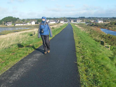
mostly sunny and warm, though the wind remained strong.
Location: Malltraeth to Dwyran.
Distance: 9 miles.
Total distance: 3572 miles.
Terrain: A cycle track on the sea bank. Beautiful forest walks. A sandy beach. Some quiet roads. Boggy tracks and fields. Stepping stones across a river.
Tide: In.
Rivers: No.424, Afon Cefni. No.425, Afon Braint — which we crossed on stepping stones, HELP!
Ferries: None.
Piers: None.
Kissing gates: Nos.652 to 655, all towards the end of the Walk.
Pubs: None.
‘Cadw’ properties: None.
Ferris wheels: None.
Diversions: None, because I was brave enough to cross the stepping stones!
How we got there and back: We were staying in a cosy little holiday cottage near Criccieth. This morning we drove from there to Dwyran where we parked just round the corner from a bus stop. From there we caught a bus to Malltraeth and alighted right next to the car park where we finished the last Walk.
At the end we
finished the official Walk in the fields south of the village. We walked across a couple of soggy fields and
emerged on the bypass. We crossed this
and walked into the village, soon realising that we weren’t on the road we
thought we were. I was walking on
looking at the map, trying to work out where we really were when I practically
ran into our parked car! So we had our
tea and chocolate biscuits, then we drove back to our cosy little cottage.
 We crossed the bridge over Afon Cefni which was canalised in 1824, but I
can’t find out why. Was it something to
do with the copper industry?
We crossed the bridge over Afon Cefni which was canalised in 1824, but I
can’t find out why. Was it something to
do with the copper industry?
 The estuary
on the southern side of the bridge is an important nature reserve. We walked across “The Cob” which is a raised
bank alongside the estuary. My! It was cold out there! A bitter wind cut across the sands — I put my
hood up and Colin got out his furry hat.
We were both still wearing our full wet-weather gear, which is also
windproof, because we didn’t trust the weather despite the clearing skies. (There had been torrential downpours until
the early hours, and we had left the cottage in the rain this morning.)
The estuary
on the southern side of the bridge is an important nature reserve. We walked across “The Cob” which is a raised
bank alongside the estuary. My! It was cold out there! A bitter wind cut across the sands — I put my
hood up and Colin got out his furry hat.
We were both still wearing our full wet-weather gear, which is also
windproof, because we didn’t trust the weather despite the clearing skies. (There had been torrential downpours until
the early hours, and we had left the cottage in the rain this morning.)
 After about a mile we came to a picnic area which was much more sheltered
as it was amongst trees. We sat at a
picnic table and ate our quiche/pasty.
There was a permanent step there to mount horses, and we watched two
girls use it to set off on ponies accompanied by a woman walking with a
dog. We followed the same track into the
forest because it was the official coast path.
It was a wide track with hardcore, but was actually quite muddy after
all the rain we’ve been having. It was
not the type of forest path we had been led to believe it would be from looking
at the map, more like a rough muddy road.
We found it to be a bit soul-destroying.
After about a mile we came to a picnic area which was much more sheltered
as it was amongst trees. We sat at a
picnic table and ate our quiche/pasty.
There was a permanent step there to mount horses, and we watched two
girls use it to set off on ponies accompanied by a woman walking with a
dog. We followed the same track into the
forest because it was the official coast path.
It was a wide track with hardcore, but was actually quite muddy after
all the rain we’ve been having. It was
not the type of forest path we had been led to believe it would be from looking
at the map, more like a rough muddy road.
We found it to be a bit soul-destroying.
After a mile or so we turned right through a muddy puddle on to a delightful forest path. This was much better! It was great to look upwards through the trees to the blue sky beyond.

 The path
took us out to the estuary which was marshy.
We could see a manor house in the woods on the opposite side — we had
passed entrances to this estate when walking along a lane on our last Walk. It was windy out in the open but not cold
because, unlike The Cob, we had trees partially sheltering us on one side. We could see the pony riders ahead, we must
have been following them. We also saw
dragonflies and butterflies in the sunshine — that’s more like it!
The path
took us out to the estuary which was marshy.
We could see a manor house in the woods on the opposite side — we had
passed entrances to this estate when walking along a lane on our last Walk. It was windy out in the open but not cold
because, unlike The Cob, we had trees partially sheltering us on one side. We could see the pony riders ahead, we must
have been following them. We also saw
dragonflies and butterflies in the sunshine — that’s more like it!
 The track led along the edge of the forest, then it turned in. We saw strange flowering palms, very pretty
but they looked totally out of place in this forest setting. We wondered who had planted them, and
why.
The track led along the edge of the forest, then it turned in. We saw strange flowering palms, very pretty
but they looked totally out of place in this forest setting. We wondered who had planted them, and
why.
 We could hear the wind in the trees
and the waves on the shore which wasn’t very far away now. It really made us feel good. It was very sheltered where we were and we
began to get quite hot. So we removed
our wet-weather gear.
We could hear the wind in the trees
and the waves on the shore which wasn’t very far away now. It really made us feel good. It was very sheltered where we were and we
began to get quite hot. So we removed
our wet-weather gear.

 The path came out on an earth road by a huge rock which looked like a
sleeping dinosaur. It looked man-made,
then we thought it may be an erratic because it seemed so out of place. We looked at the map and realised it was an
extension of the rocks which make up Llanddwyn Island — Colin was the first to
deduce that, and admitted he wouldn’t have thought of any such thing before he
started studying geology with the U3A (University of the Third Age).
The path came out on an earth road by a huge rock which looked like a
sleeping dinosaur. It looked man-made,
then we thought it may be an erratic because it seemed so out of place. We looked at the map and realised it was an
extension of the rocks which make up Llanddwyn Island — Colin was the first to
deduce that, and admitted he wouldn’t have thought of any such thing before he
started studying geology with the U3A (University of the Third Age).
 Two huge JCBs were working on the earth
road. One was a heavy roller, and as
they passed us the ground vibrated like an earthquake.
Two huge JCBs were working on the earth
road. One was a heavy roller, and as
they passed us the ground vibrated like an earthquake.
The road led down towards the beach, we could see the sea through the trees. We turned off the path, made our way over a bank and came out on the sands. It was lovely! It was not nearly so windy as it had been earlier and the sun was warm. There were quite a few people there, many were speaking Welsh. We had wonderful views of Snowdonia across the water, and of Llanddwyn Island stretching out towards the rest of Wales.
 The tide was right in, so Llanddwyn Island really was an island — most of
the time it is accessible without getting your feet wet, but not at that
moment. Also we were anxious to finish
our Walk before we began to lose daylight, so we decided to miss out Llanddwyn Island as being a dead end we didn’t
have to walk. But we hadn’t realised the
significance of the island, nor of the strange rocks on the beach.
The tide was right in, so Llanddwyn Island really was an island — most of
the time it is accessible without getting your feet wet, but not at that
moment. Also we were anxious to finish
our Walk before we began to lose daylight, so we decided to miss out Llanddwyn Island as being a dead end we didn’t
have to walk. But we hadn’t realised the
significance of the island, nor of the strange rocks on the beach.

 Two years later we revisited this beach with our local U3A Geology group —
a trip led by a university professor.
She told us that this area is a geologist’s “Mecca”.
The rocks on the beach are pillow lavas which only occur on constructive
plate margins at the very bottom of oceans.
The geology is complicated, but to put it simply Llanddwyn Island
is a remnant of a defunct ocean which was here hundreds of millions of years
ago.
Two years later we revisited this beach with our local U3A Geology group —
a trip led by a university professor.
She told us that this area is a geologist’s “Mecca”.
The rocks on the beach are pillow lavas which only occur on constructive
plate margins at the very bottom of oceans.
The geology is complicated, but to put it simply Llanddwyn Island
is a remnant of a defunct ocean which was here hundreds of millions of years
ago.
 And beautiful the rocks are too,
many coloured minerals are exposed. (On
that visit the tide was out and we walked the length of the island.)
And beautiful the rocks are too,
many coloured minerals are exposed. (On
that visit the tide was out and we walked the length of the island.)
Llanddwyn Island was also revered as a holy place by our ancestors. Dwynwen was a 5th century saint who lived as a hermit on the island after her love affair turned sour. She was said to be the patron saint of lovers. (Surely not the right person if she couldn’t manage her own love affairs!) If a woman scattered breadcrumbs on her holy well on the island, then laid her handkerchief over them, she could tell that her lover would be faithful if the eels in the well disturbed this arrangement. (I wouldn’t have relied on it!) This practice became very popular in Tudor times when the chapel was built, and it made the area very rich. (Another medieval scam?)
 Getting back to the Walk, we walked about a mile along this beautiful
beach.
Getting back to the Walk, we walked about a mile along this beautiful
beach.
 Though the tide was right in, the
sand was not too soft to walk on. With
the wonderful views of Snowdonia across the strait it was absolutely glorious! We approached the sand cliffs where the tide
was too far in for us to walk comfortably.
Though the tide was right in, the
sand was not too soft to walk on. With
the wonderful views of Snowdonia across the strait it was absolutely glorious! We approached the sand cliffs where the tide
was too far in for us to walk comfortably.
 We came to a dip in the cliffs — it looked like a decent path inland, it
was well-walked and we weren’t the only ones using it today. So with a last look at the wonderful view of
Snowdonia across the water we turned into the forest.
We came to a dip in the cliffs — it looked like a decent path inland, it
was well-walked and we weren’t the only ones using it today. So with a last look at the wonderful view of
Snowdonia across the water we turned into the forest.
 The path led us up and down through woods. We could see the official path which runs
parallel to the beach but we had to climb over a fence to get to it. It was not a barbed wire fence so that wasn’t
too difficult, but why was it there? We
came to “Trim Trail”, a picnic site with gym apparatus like parallel bars, and
there was nobody there. But we both wanted the loos which we knew
were around somewhere, so we looked on the map.
We deduced we must climb a sandy hill behind “Trim Trail”, and there we
saw just below us the roof of the loo block in a huge car park. The toilets were clean, open and free — well
done to whoever was responsible for them!
Feeling much more comfortable, we sat at a windy picnic table to eat our
sandwiches and apples.
The path led us up and down through woods. We could see the official path which runs
parallel to the beach but we had to climb over a fence to get to it. It was not a barbed wire fence so that wasn’t
too difficult, but why was it there? We
came to “Trim Trail”, a picnic site with gym apparatus like parallel bars, and
there was nobody there. But we both wanted the loos which we knew
were around somewhere, so we looked on the map.
We deduced we must climb a sandy hill behind “Trim Trail”, and there we
saw just below us the roof of the loo block in a huge car park. The toilets were clean, open and free — well
done to whoever was responsible for them!
Feeling much more comfortable, we sat at a windy picnic table to eat our
sandwiches and apples.


The path continued from a corner of the car park through woods to the eastern edge of the forest. There we turned north-east and walked along the edge of the forest, just within the trees, for about a mile. The sun was shining brightly and we loved the interplay of light as it fell between the trees.
 Newborough Warren was on our
right, not the sea. There are paths
across the Warren, but they are tidal and come
to a dead end when they reach the Menai
Strait. So we didn’t walk them, there was no point. The Warren
has been grazed by ponies ever since the myxomatosis crisis of 1954 wiped out
the rabbits. (Colin and I both remember
how scrubland shot up that summer because there were no rabbits grazing. I was nine years old, and remember the grassy
slopes in Arundel
Park disappearing under a
mass of ragwort and brambles.)
Newborough Warren was on our
right, not the sea. There are paths
across the Warren, but they are tidal and come
to a dead end when they reach the Menai
Strait. So we didn’t walk them, there was no point. The Warren
has been grazed by ponies ever since the myxomatosis crisis of 1954 wiped out
the rabbits. (Colin and I both remember
how scrubland shot up that summer because there were no rabbits grazing. I was nine years old, and remember the grassy
slopes in Arundel
Park disappearing under a
mass of ragwort and brambles.)
 The path turned away from the forest — there was still the Warren to the right but
now there were fields and a pond to our left.
We came to a car park cum picnic site with a weird sculpture of marram
grass stooks. A notice told us, “This sculpture depicts the ‘gafrod’ of
marram grass, harvested and drying in the sun.
Newborough residents used to harvest the grass every two years and leave
it to dry from its green colour to a golden yellow. ‘Gafrod’ was a local term for the bundles of
marram standing on end, gathered and tied at the top with a plaited cord of
marram.”
The path turned away from the forest — there was still the Warren to the right but
now there were fields and a pond to our left.
We came to a car park cum picnic site with a weird sculpture of marram
grass stooks. A notice told us, “This sculpture depicts the ‘gafrod’ of
marram grass, harvested and drying in the sun.
Newborough residents used to harvest the grass every two years and leave
it to dry from its green colour to a golden yellow. ‘Gafrod’ was a local term for the bundles of
marram standing on end, gathered and tied at the top with a plaited cord of
marram.”
 We sat at a table to eat our chocolate.
A group of ponies were carrolled in a pen at the side of the car
park. Some men turned up with a
horse-trailer and started inspecting and sorting them. They all spoke in Welsh so we had no idea
what they were saying.
We sat at a table to eat our chocolate.
A group of ponies were carrolled in a pen at the side of the car
park. Some men turned up with a
horse-trailer and started inspecting and sorting them. They all spoke in Welsh so we had no idea
what they were saying.
We walked along a road for a short way, then turned down a track towards Afon Braint. Colin saw a stoat, but it had run away before I caught sight of it. As we approached the river we were getting a little worried because we couldn’t see the footbridge we thought was there. That’s because there wasn’t one, there were stepping stones! (We should have looked more carefully at the map, it is clearly marked as stepping stones at that point.)
 The stones were real rocks which had been
squared off, and they were more or less flat-topped. The gaps between them weren’t too big, though
one in the middle was a bit wider. The
river was running fast after all the rain we have had, and the crossing looked
daunting.
The stones were real rocks which had been
squared off, and they were more or less flat-topped. The gaps between them weren’t too big, though
one in the middle was a bit wider. The
river was running fast after all the rain we have had, and the crossing looked
daunting.
 Colin was confident, but I was
a little nervous — this type of situation is where my lack of 3D vision becomes
a real handicap. I glanced at the map to
look for an alternative route, then I said, “I’m
not going back to that b****y road!”
In my own time I leapt safely from stone to stone with great aplomb,
even over the bigger gap in the middle.
I was quite proud of myself!
(Colin did take a photo of me doing it, but that was one of the ones
that got deleted.) We then had only a
quarter of a mile to go — along a marshy river bank, then through some fields
until we were at the nearest point to Dwyran.
Colin was confident, but I was
a little nervous — this type of situation is where my lack of 3D vision becomes
a real handicap. I glanced at the map to
look for an alternative route, then I said, “I’m
not going back to that b****y road!”
In my own time I leapt safely from stone to stone with great aplomb,
even over the bigger gap in the middle.
I was quite proud of myself!
(Colin did take a photo of me doing it, but that was one of the ones
that got deleted.) We then had only a
quarter of a mile to go — along a marshy river bank, then through some fields
until we were at the nearest point to Dwyran.
 That ended Walk no.346, we shall pick up Walk no.347 next time on a
footpath just south of Dwyran. It was
half past three, so the Walk had taken us five hours fifty minutes. We walked across a couple of soggy fields and
emerged on the bypass. We crossed this and
walked into the village, soon realising that we weren’t on the road we thought
we were. I was walking on looking at the
map, trying to work out where we really were when I practically ran into our
parked car! So we had our tea and
chocolate biscuits, then we drove back to our cosy little cottage.
That ended Walk no.346, we shall pick up Walk no.347 next time on a
footpath just south of Dwyran. It was
half past three, so the Walk had taken us five hours fifty minutes. We walked across a couple of soggy fields and
emerged on the bypass. We crossed this and
walked into the village, soon realising that we weren’t on the road we thought
we were. I was walking on looking at the
map, trying to work out where we really were when I practically ran into our
parked car! So we had our tea and
chocolate biscuits, then we drove back to our cosy little cottage.


After a mile or so we turned right through a muddy puddle on to a delightful forest path. This was much better! It was great to look upwards through the trees to the blue sky beyond.


The road led down towards the beach, we could see the sea through the trees. We turned off the path, made our way over a bank and came out on the sands. It was lovely! It was not nearly so windy as it had been earlier and the sun was warm. There were quite a few people there, many were speaking Welsh. We had wonderful views of Snowdonia across the water, and of Llanddwyn Island stretching out towards the rest of Wales.


Llanddwyn Island was also revered as a holy place by our ancestors. Dwynwen was a 5th century saint who lived as a hermit on the island after her love affair turned sour. She was said to be the patron saint of lovers. (Surely not the right person if she couldn’t manage her own love affairs!) If a woman scattered breadcrumbs on her holy well on the island, then laid her handkerchief over them, she could tell that her lover would be faithful if the eels in the well disturbed this arrangement. (I wouldn’t have relied on it!) This practice became very popular in Tudor times when the chapel was built, and it made the area very rich. (Another medieval scam?)


The path continued from a corner of the car park through woods to the eastern edge of the forest. There we turned north-east and walked along the edge of the forest, just within the trees, for about a mile. The sun was shining brightly and we loved the interplay of light as it fell between the trees.


We walked along a road for a short way, then turned down a track towards Afon Braint. Colin saw a stoat, but it had run away before I caught sight of it. As we approached the river we were getting a little worried because we couldn’t see the footbridge we thought was there. That’s because there wasn’t one, there were stepping stones! (We should have looked more carefully at the map, it is clearly marked as stepping stones at that point.)


No comments:
Post a Comment